
The sharp, pine-scented chill of crushed eucalyptus leaves fills your lungs as you stand at the precipice, looking down into the indigo depths of Jamison Valley. A distant, hollow call from a kookaburra bounces off the sheer sandstone walls, echoing back to you like an ancient greeting. Before your eyes lies a vast tapestry of blue mist, clinging to the dense rainforest pockets below and softening the jagged ridgelines of the Greater Blue Mountains World Heritage Area. This is not merely a backdrop; it is a living, breathing entity that demands respect. The air here feels heavier with history, carrying the whispers of First Nations peoples who have walked these red-earth tracks for millennia. Taking that first step onto the dusty path is an act of surrender to this landscape, trading the noise of modern life for the rhythmic crunch of boots on gravel and the white noise of wind through the gums. You are no longer just a visitor; you are a participant in an ongoing geological and ecological story.
The Geology of the Trail: Why Blue Mountains Hiking is Unique
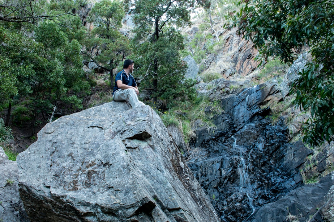
To understand hiking in the Blue Mountains, you must first understand the stone beneath your feet. This region is not a random collection of hills but a massive, folded escarpment formed over 300 million years. The distinctive blue hue that gives the mountains their name is caused by the way sunlight scatters off the oil droplets released when eucalyptus leaves are crushed by wind or rain. However, the hiking experience itself is dictated by the geology: layers of Hawkesbury Sandstone sitting atop softer shale and clay.
This geological stratification creates unique trail conditions that differ vastly from hiking in granite ranges or volcanic highlands. The sandstone is incredibly durable, forming the dramatic cliffs and plateaus that offer those iconic postcard views. Yet, when it rains, the softer shale layers beneath can become slick, and water seeping through the porous sandstone creates surface runoff that turns dry tracks into treacherous slides.
Read the Rock: Identifying Safe Footing
Expert hikers don’t just look at the path; they read the landscape. In the Blue Mountains, distinguishing between stable sandstone and unstable shale is a critical safety skill.
Safe Footing Indicators:
* Exposed Rock Surfaces: Look for flat, grey rock slabs. These are often the tops of sandstone layers and provide excellent grip even when damp.
* Angular Rock Chips: Small, angular pieces of rock on the trail suggest a sandstone-rich surface that drains quickly.
Caution: Slippery Hazards:
* Fine Dust/Clay Colours: If the trail surface appears brown, reddish, or has a smooth, almost waxy appearance, you are likely on shale or clay layers. These become extremely slippery when wet. Avoid stepping directly onto these surfaces after rain; stick to the edges where vegetation holds the soil together.
* Moss Growth: In shaded gullies, moss can grow on sandstone itself. While beautiful, this creates a natural lubricant. Test your footing carefully, especially near drops.
Understanding these geological nuances transforms your hike from a guesswork exercise into a calculated navigation of the terrain. It explains why certain trails, like those in the Wentworth Falls district, can be hazardously slick just days after a light shower, while others in the Blue Rocks area remain firm.
The Hiker’s Spectrum: Curated Trails for Every Pace
The Blue Mountains offer a diversity of trails that cater to everyone from families with strollers to ultra-endurance athletes. Rather than viewing the region as a monolith, it is more useful to categorise trails by physical demand and scenic reward.
The Gentle Stroll: Accessible Wonders
For families, casual walkers, or those recovering from injury, the Blue Mountains offer some of Australia’s most accessible viewpoints. These trails are typically paved or well-maintained gravel, with minimal elevation gain.
* Govetts Leap Arcade (Emu Plains): This is a masterclass in accessible design. A wooden walkway extends out over the cliff edge, providing an unobstructed view of the Grose Valley without requiring any steep climbing. It is perfect for prams and wheelchairs.
* Katoa to Megalong Valley: A short, flat walk through a beautiful valley that offers historical context via old mill ruins.
Actionable Advice: These trails are popular on weekends. To avoid crowds, visit early in the morning or later in the afternoon. Bring a camera; the light through the eucalypt canopy is magical during ‘golden hour’.
The Intermediate Challenge: Iconic Day Hikes
These hikes require a moderate level of fitness but offer some of the most rewarding views in New South Wales. They typically involve 5–10 kilometers with significant elevation changes.
* Grand Canyon Walk: Despite the name, it is not a deep canyon but a series of gorges. The 7km loop takes you through narrow, towering rock walls that make you feel like an insect. It is steep in sections but well-marked.
* Prince Henry Cliff Walk (Part 1): Starting from Prince Henry Park, this walk offers stunning views of the Nepean River. It is less crowded than the main cliff walks and allows for flexibility—you can turn back at any point.
Expert Tip: Always carry more water than you think you need for intermediate hikes. The dry, windy conditions at elevation cause rapid dehydration, even if you don’t feel like you are sweating heavily.
The Expert’s Crucible: Multi-Day and Steep Ascents
For those seeking a physical test, the Blue Mountains offer trails that demand technical skills, stamina, and careful planning.
* Mount Solitary Track: This is the ultimate test of endurance in the region. It involves a grueling 24km round trip with an elevation gain of over 1,000 meters. The final ascent is a steep, sustained climb that leaves most visitors breathless.
* Wolgan Valley to Sunset Creek: A multi-day backpacking trip through remote wilderness. There are no facilities, and you must carry all water and food. It requires navigation skills and self-sufficiency.
Key Takeaways:
* Duration: Expert hikes can take 8–12 hours or multiple days. Start early (before 7am) to maximise daylight.
* Gear: Sturdy ankle-supporting boots are non-negotiable for rocky, uneven terrain.
* Check Maps: Topographic maps are essential. Trail markers can be faint in remote areas.
The Unseen Costs: Preparation, Permits, and Local Nuances
Guidebooks often omit the less romantic aspects of hiking: the lack of signal, the strict regulations, and the unpredictable weather. Preparing for these “unseen costs” is what separates a memorable adventure from a dangerous ordeal.
The Reality of Connectivity
In deep valleys and along ridgelines, mobile phone signal is sporadic at best. Warning: Do not rely on your phone for navigation or emergency calls in the Blue Mountains. Download offline maps from apps like AllTrails or Maps.me before you leave populated areas. Inform someone of your itinerary and expected return time, as rescue operations can be complicated by the lack of direct road access to some trailheads.
Water and Weather: The Dry Wind Factor
The Blue Mountains are known for their dry, windy conditions. This is not a tropical environment where humidity keeps you hydrated; the wind strips moisture from your skin and lungs rapidly.
* Hydration Strategy: Carry at least 3 litres of water for intermediate hikes and more for expert treks. Electrolyte tablets are recommended to prevent cramping.
* Wind Chill: Even in summer, temperatures at the summit of Mount Solitary can be 10–15°C cooler than at the valley floor. Layering is essential. A windbreaker or softshell jacket should be in your pack regardless of the forecast.
Story 1: The “False Summit” at Mount Solitary
I learned the hard way about the psychological toll of hiking in this region. On my first attempt at Mount Solitary, I pushed through the final steep section, heart pounding, only to crest the ridge and see… another peak. And behind that, yet another. The “false summit” effect is real in the Blue Mountains due to the undulating nature of the sandstone plateaus. It is a mental game as much as a physical one. Checking your topographic map carefully and understanding that visual cues can be deceptive in the haze saves you from despair when you don’t see your destination immediately.
Dog Regulations and Local Rules
A critical nuance often overlooked by visitors: Dogs are prohibited on most major hiking trails in the Blue Mountains National Park. This is to protect native wildlife, particularly ground-nesting birds and small marsupials. Only specific dog-friendly trails exist, usually outside the national park boundaries or in designated recreation areas. Always check the NSW National Parks website for current dog policies before bringing your pet.
Safety Note: If you bring a dog, ensure it is leashed at all times and that you are using an approved dog-friendly trail. Breaking these rules can result in significant fines and puts wildlife at risk.
Beyond the Postcard: Sustainable Hiking and Community Resources
Hiking in the Blue Mountains is a privilege, not a right. The ecosystems here are fragile, and human impact can be devastating if left unchecked. Sustainable hiking is about minimising your footprint while maximising your connection to the land.
Leave No Trace: Specific Guidelines for Blue Mountains
* Stay on Marked Trails: The roots of the ancient trees, particularly the White Bloodwood and Gymea Lilies, are shallow and easily damaged. Straying from trails causes erosion that is hard to repair.
* Protect Endemic Flora: The Blue Mountains are home to the iconic Lemon Scented Gum. Do not pick leaves or branches for scent; let them be.
* Waste Management: There are no bins on most trails. Carry out all rubbish, including biodegradable items like fruit peels, which can disrupt local wildlife feeding habits.
Story 2: The Rain at Wentworth Falls
A sudden summer storm once turned a dry, dusty track near Wentworth Falls into a treacherous mudslide within minutes. The sky was blue when I started the hike, but by the time I reached the mid-point, rain lashed down horizontally. The wind speeds on exposed ridges can be dangerous even if it isn’t raining directly overhead. Always check detailed weather forecasts, not just for rain, but for wind speeds. If high winds are predicted, avoid ridge-top walks and seek lower-elevation tracks.
Story 3: The Encounter with a Eastern Grey Kangaroo
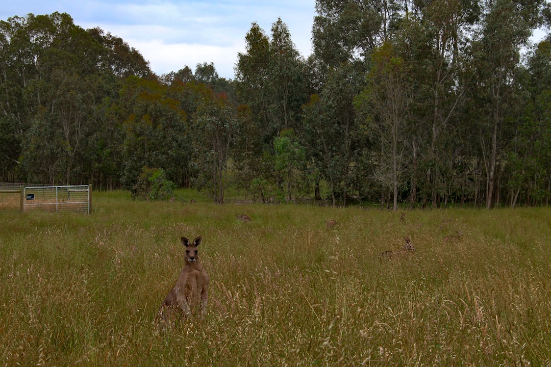
On the Prince Henry Cliff Walk, I froze. An adult Eastern Grey kangaroo stood just metres away, calmly grazing near the edge of the cliff. It was a moment of pure, unscripted beauty. However, it also served as a reminder: we are guests in their home. I maintained a respectful distance, did not attempt to feed it, and slowly backed away. Feeding wildlife is illegal and dangerous for the animals, as it alters their natural behaviour and makes them vulnerable to predators or traffic. Respectful observation is the only ethical interaction.
Community Resources and Sustainable Contribution
You can contribute to the preservation of these trails through community engagement.
* Leave No Trace Australia: Provides comprehensive guidelines on ethical outdoor practices.
* Blue Mountains Conservation Society: A local group dedicated to protecting the region’s biodiversity. Consider volunteering for trail maintenance days or donating to support their efforts.
* Fire Ban Checks: Always check the Fire Danger Ratings for NSW before hiking, especially during summer. Many trails close during high-risk periods to prevent accidental fires.
Resource Links:
* [NSW National Parks Blue Mountains Guide](https://www.npws.nsw.gov.au/recreation/parks/blue-mountains)
* [Leave No Trace Australia](https://leavenotraceaustralia.org.au/)
* [Blue Mountains Conservation Society](https://www.bmcs.org.au/)
Conclusion: The View Earned
Hiking in the Blue Mountains is not about conquering nature; it is about engaging with it on its own terms. As you pack your bag, remember that the goal is not just to reach a summit but to carry back a deeper understanding of this ancient landscape.
Consider what you will leave behind—not just footprints, but a commitment to sustainability—and what you will bring back: a quieter mind, a stronger body, and a profound respect for the intricate balance of life in the mountains.
We encourage you to share your discoveries responsibly. Tag local conservation groups, follow Leave No Trace principles, and inspire others to tread lightly. The trails here are timeless, but they require our active stewardship to remain wild for future generations.
So, lace up your boots. Check the weather. Respect the wildlife. And step out onto the trail with clean feet and an open heart. The blue mist is waiting, and it has stories to tell.
Frequently Asked Questions
What geological factors make Blue Mountains trails unique and potentially hazardous?
The Blue Mountains are defined by Hawkesbury Sandstone sitting atop softer shale and clay layers, creating distinct trail conditions. While the durable sandstone forms stable cliffs and plateaus, rain seeping through porous rock can turn shale layers into slick, treacherous slides. Hikers must identify safe footing by looking for flat, grey rock slabs or angular rock chips, which drain quickly. Conversely, trails with fine dust, reddish clay colours, or smooth waxy appearances indicate unstable shale that should be avoided after rain. Additionally, moss growth on shaded sandstone gullies acts as a natural lubricant, requiring careful testing of footing near drops.
How can hikers access scenic viewpoints without strenuous climbing?
For those seeking accessible wonders, the Govetts Leap Arcade in Emu Plains offers a masterclass in inclusive design. This wooden walkway extends directly over the cliff edge, providing unobstructed views of the Grose Valley without requiring steep climbing or significant elevation gain. It is specifically designed to be perfect for prams and wheelchairs, making it an ideal choice for families or individuals with mobility challenges. Another option is the short, flat Katoa to Megalong Valley walk, which features historical context via old mill ruins. To avoid crowds on these popular trails, it is advisable to visit early in the morning or later in the afternoon.
What are the requirements and challenges of tackling expert-level hikes like Mount Solitary?
Expert hikes such as the Mount Solitary Track demand significant physical endurance and technical preparation. This 24km round trip involves an elevation gain of over 1,000 meters, featuring a grueling final ascent that can leave hikers breathless. It typically takes 8–12 hours to complete, so starting before 7am is crucial to maximise daylight. Sturdy ankle-supporting boots are non-negotiable for the rocky, uneven terrain. Furthermore, hikers must carry topographic maps as trail markers can be faint in remote areas. The region is also known for ‘false summits’ caused by undulating sandstone plateaus, so mental resilience and careful map reading are essential to avoid despair when destinations appear deceptive.
What are the current regulations regarding dogs and wildlife interaction in the park?
Dogs are strictly prohibited on most major hiking trails within the Blue Mountains National Park to protect native wildlife, particularly ground-nesting birds and small marsupials. Only specific dog-friendly trails exist outside the national park boundaries or in designated recreation areas, and pets must be leashed at all times on these approved paths. Breaking these rules can result in significant fines and endangers local fauna. Regarding wildlife, interactions with animals like Eastern Grey kangaroos must be respectful and distant. Feeding wildlife is illegal as it alters natural behaviour, making animals vulnerable to predators or traffic; hikers should only observe from a safe distance without attempting to interact.




Be the First to Comment
Sign in to start the conversation.